TOBOSO Infrastructure
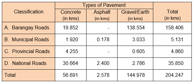
Road Network and Classification
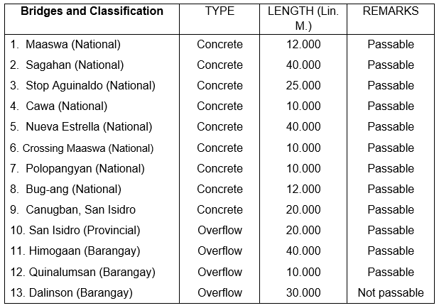
Inventory of Bridges
Status of Power Connection
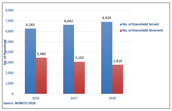
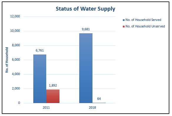
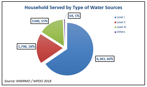
Status of Status of Water Supply
toboso
Negros Occidental
About us
Toboso is a coastal municipality in the province of Negros Occidental. The municipality has a land area of 117.33 square kilometers or 45.30 square miles which constitutes 1.50% of Negros Occidental’s total area. Its population as determined by the 2015 Census was 42,114. This represented 1.69% of the total population of Negros Occidental province, or 0.56% of the overall population of the Western Visayas region. Based on these figures, the population density is computed at 359 inhabitants per square kilometer or 930 inhabitants per square mile.
summary data
Type: Municipality
Island Group: Visayas
Region: Western Visayas
(Region VI)
Province: Negros Occidental
Barangay Count: 9
Coastal/Landlocked: Coastal
Marine Water Bodies: Tañon Strait
Geographical Location: The municipality of Toboso is located on the northeastern side of the province of Negros Occidental and is facing the island of Cebu. It is bounded on the southwest by the municipality of Calatrava; Northwest by the city of Sagay; north by the municipality of Escalante and east by Tañon Strait. The shoreline runs along the Tañon Strait from Calatrava boundary to the Escalante boundary facing east.
Coordinates: 10º40’00” N to 10º42’56” latitude and 123º20’00” E to 123º30’51” longitude.
Land Area: DBM: 11,733 has.
DENR 2013: 12,134.18 has.
Historical Data: 12,340 has.


